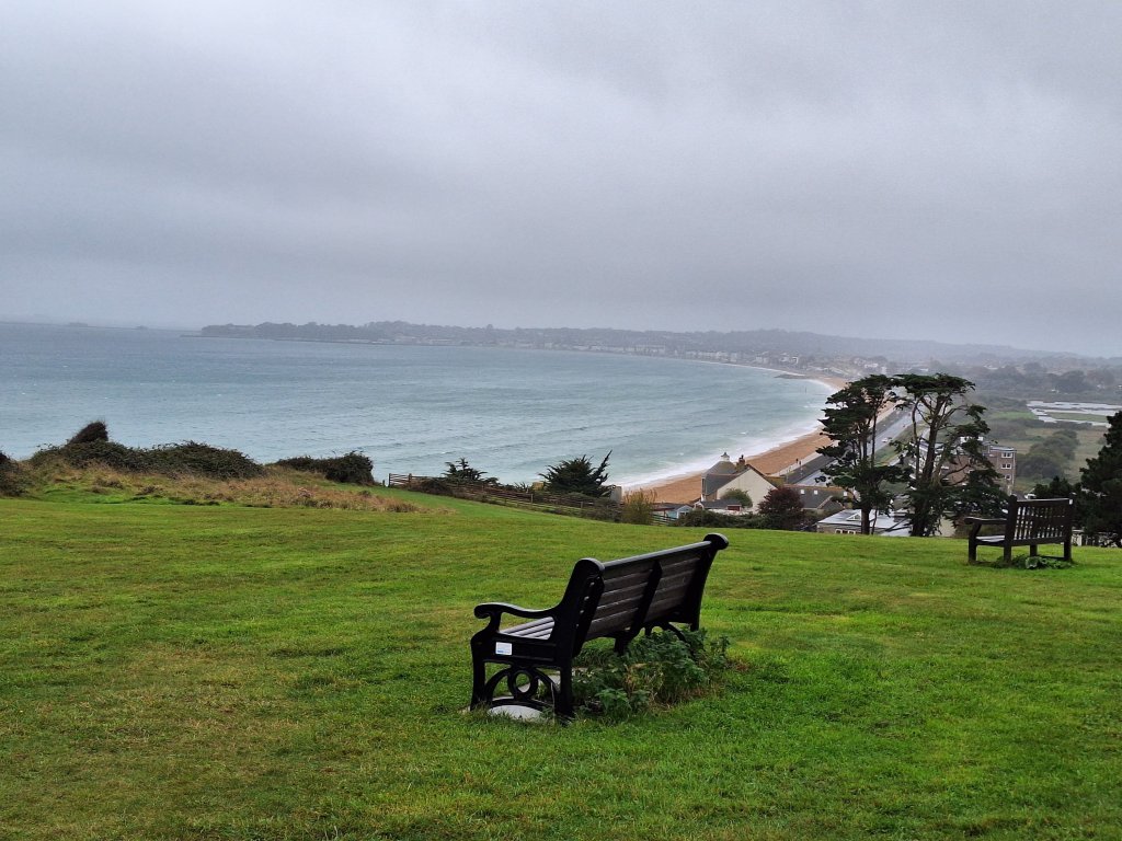
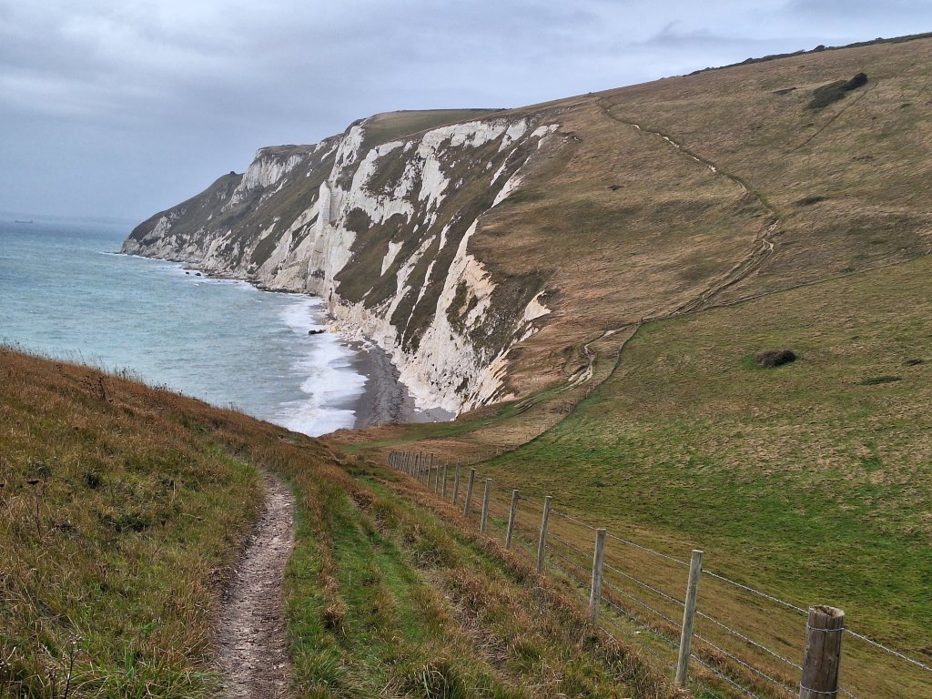
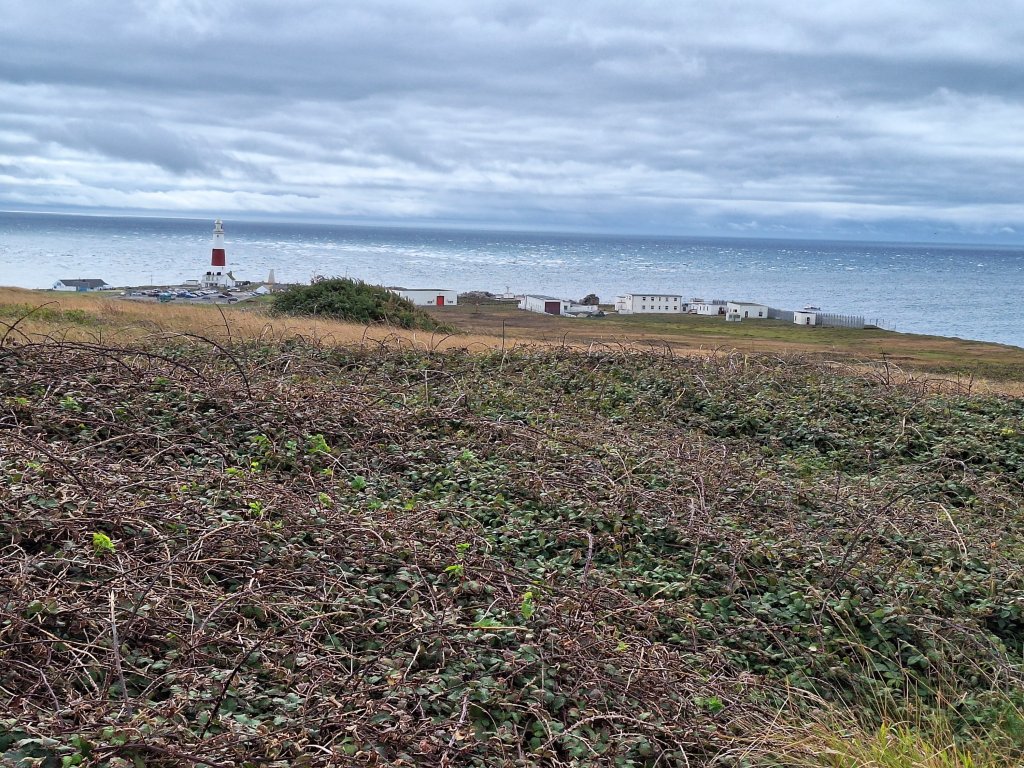
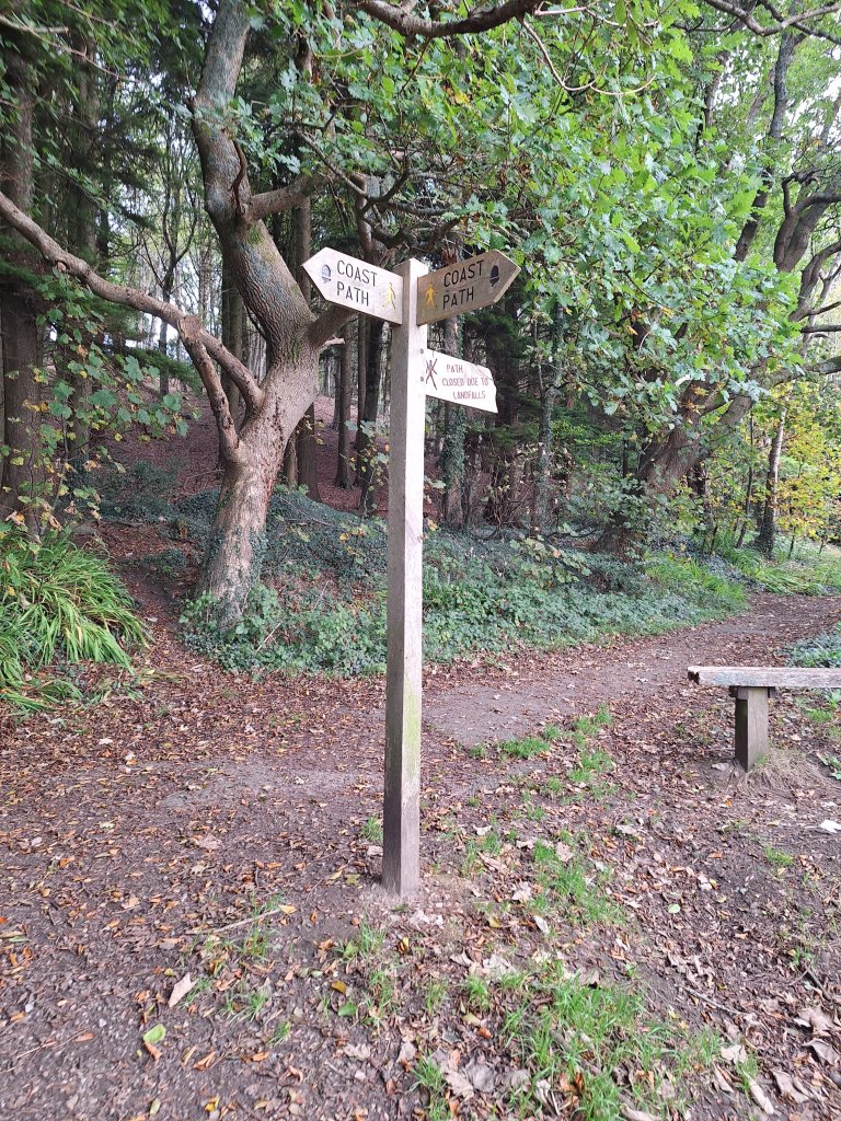
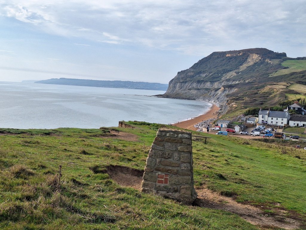
The final day on the SWCP. At 7 miles, this is the shortest day on the path. With Rob accompanying me, it was a day to take slowly and savour. Also, a day that was different to all those that have gone before, not least due to the unseasonably bitter brisk wind, necessitating the wearing of my padded jacket, woolly hat and, initially, even gloves. A complete contrast to conditions last Monday when I sunbathed on top of Golden Cap in T-shirt and shorts.
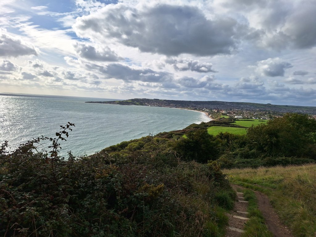
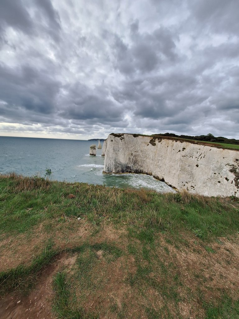
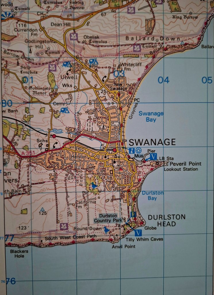
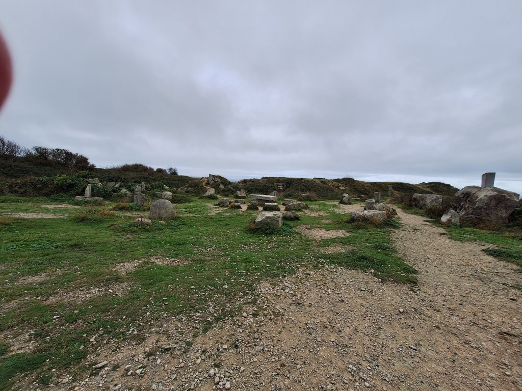
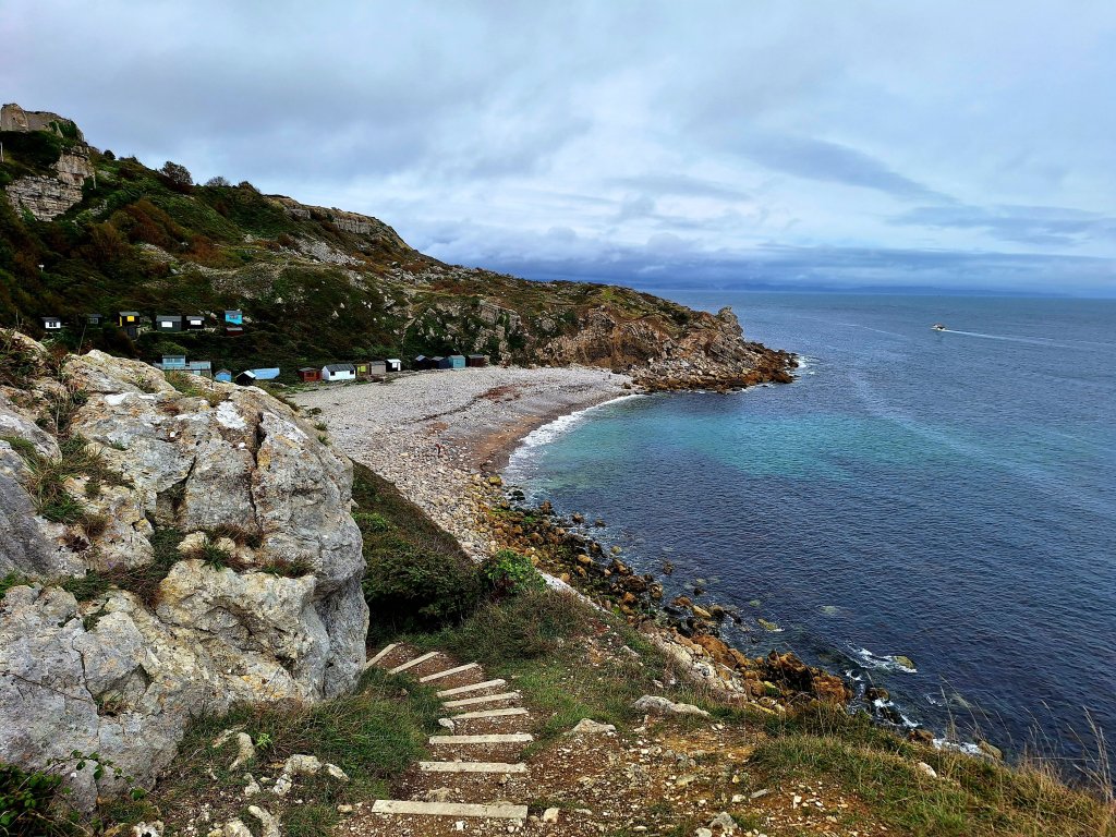
Our B&B is just 50 yards from the path, which continued through residential streets for a short distance before emerging out onto the low cliffs, then heading higher onto Ballard Cliff, with views back across Swanage Bay as well as to the Isle of Wight and Bournemouth. Here we really felt the wind coming straight at us. The main attraction on this final part of the path is Old Harry’s Rocks, remarkable chalk pinnacles and stacks rising out of the icy-blue sea. Dad didn’t comment on these but does mention following the cliffline, soaking up the views knowing that he would soon be heading home
Heading off towards Ballard CliffClimbing up to Ballard Cliff with Swanage behind usOld Harry’s Rocks
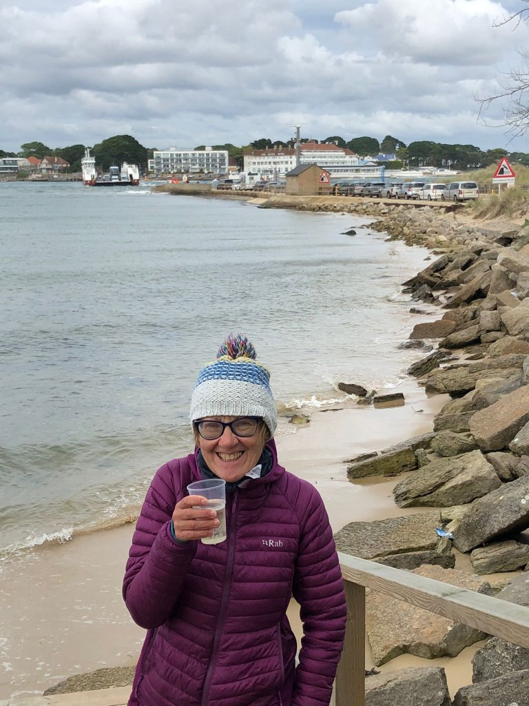
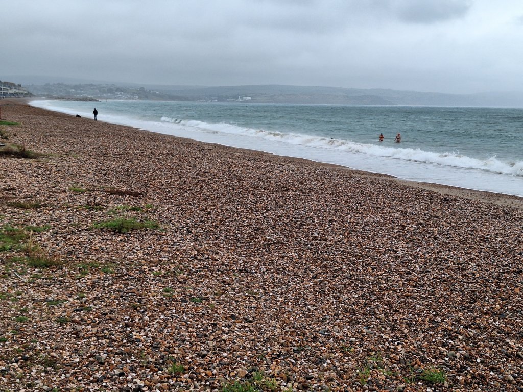
We enjoyed some lunch inside a cafe at Studland beach and from there we followed in Dad’s footsteps on the 2-mile beach walk to the end, exhilarating today as the waves rolled in, a fitting way to finish a coastal path. Rounding the corner to Shell Beach, we could see the narrow gap of Poole harbour and the vehicular chain ferry that makes the short crossing every few minutes.
Studland beach
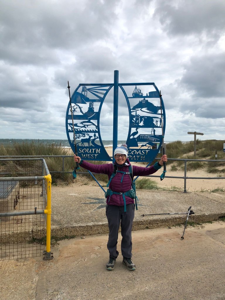
And then there was the marker for the end of the SWCP. Photos duly taken, I enjoyed a prosecco in a plastic cup in the outdoor seating area of a nearby posh bar and a very brief paddle in the calmer waters of Poole harbour before we boarded the bus back to Swanage. When Dad had arrived here 25 years ago the end marker had yet to be erected. He simply boarded the ferry and went home.
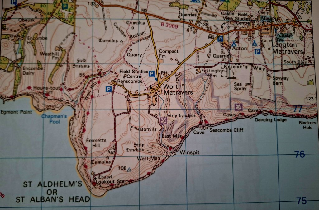
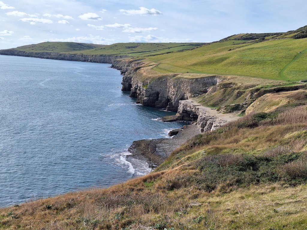
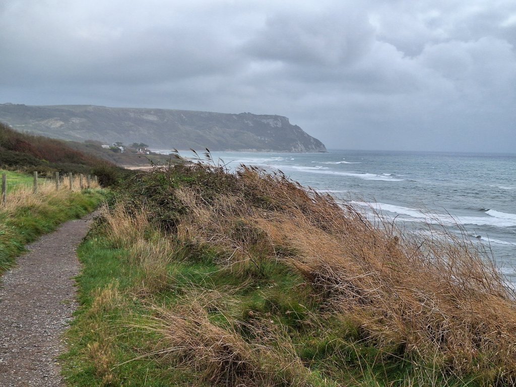
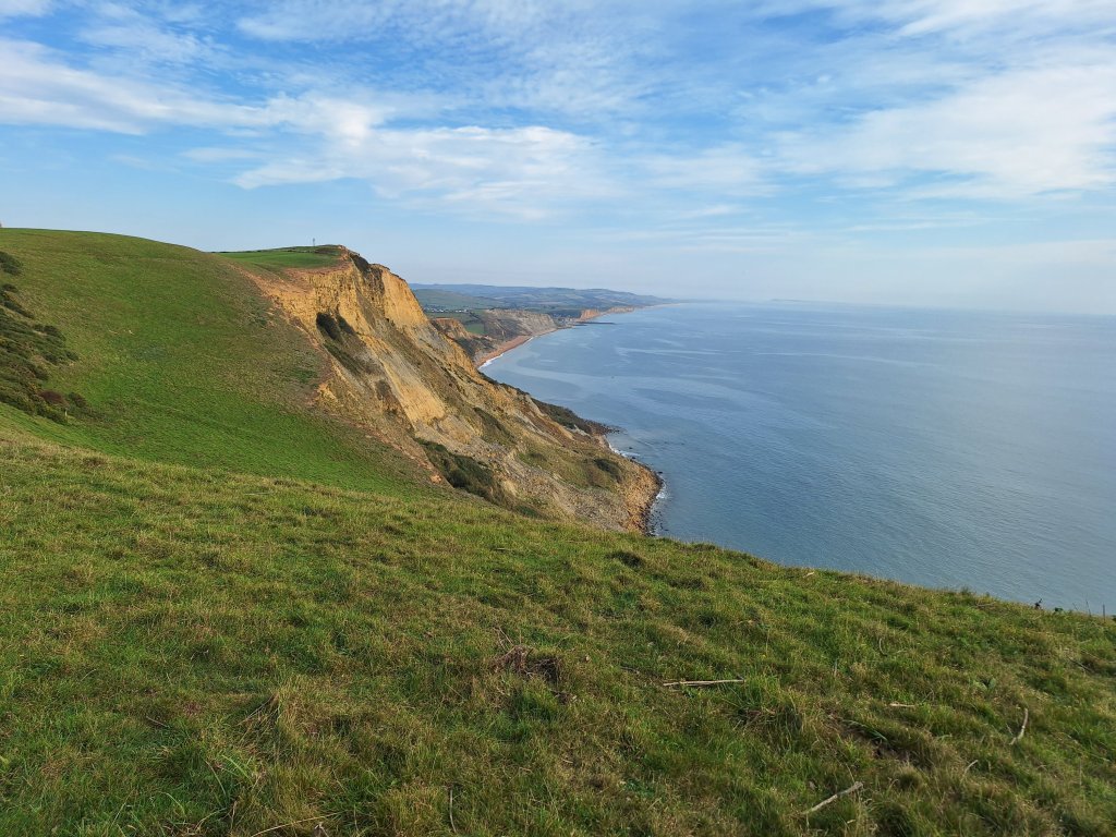
Another glorious chilly morning and at Gaulter Gap the car park was already filling up, though on the path it was initially quiet, just a few runners and walkers about. There were good views from the lowish cliff-line back along yesterday’s route and ahead to St Aldhelm’s Head, the mound of Swyre Head to my left, and a sparkling sea to my right, with slate ledges just starting to emerge as the tide receded. The path was initially easy, dissected by a few streams/rivulets with footbridges over, though occasionally uncomfortably close to the edge.
Since Gaulter Gap, I had probably been walking in Dad’s footsteps but it seems he was soon diverted back inland as far as Kingston, his way apparently barred by a country estate, although this isn’t mentioned as a problem in the 1998 guide. So he found himself just 2 miles from Church Knowle, where he had been earlier, having probably walked a circuit of 7 to 8 miles to get there! From his description I think he would have missed the most difficult section of my day so far, where the path having become more undulating, descended via some difficult, narrow and overgrown steps almost to sea level before climbing steeply to Houns-Tout cliff (150m). The view from the top was worth the climb but the subsequent precipitous descent down 200+ steps was challenging.
View west from Houns-Tout View east to Chapman’s Pool and St Aldhelm’s Head from the start of the descent from Houns-Tout
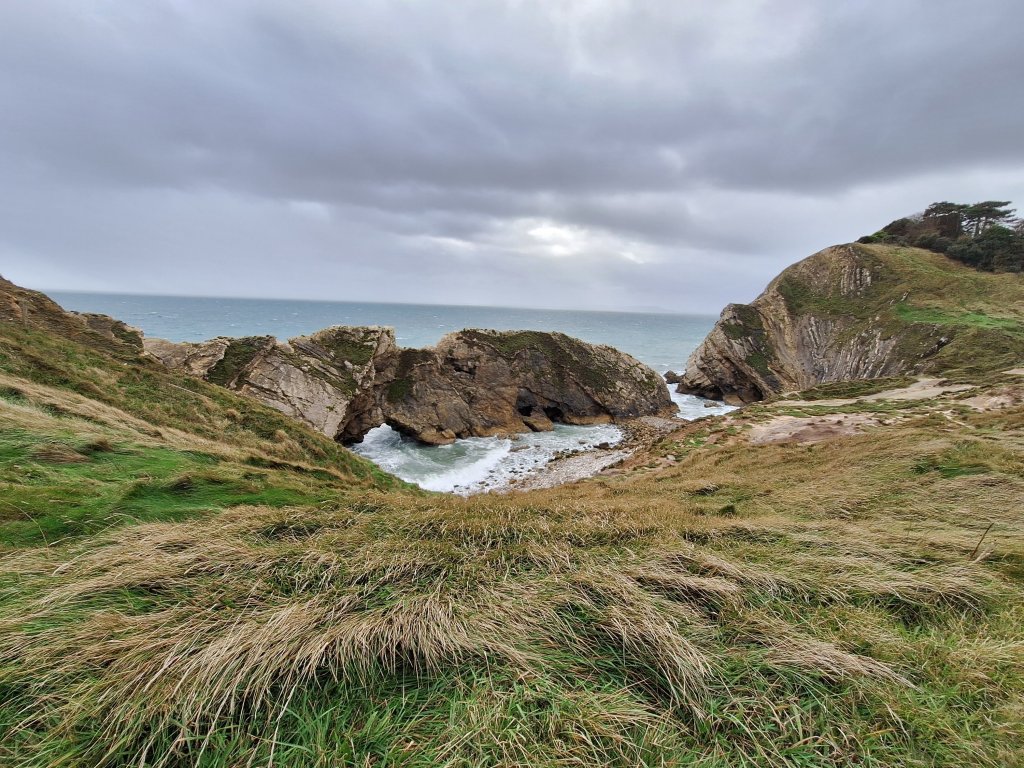
Having reached the bottom of the steps, the path went inland to avoid the unstable area above the beautiful Chapman’s Pool. Having wound my way back seaward and then up the hill the other side of Chapman’s Pool, a bench above this beautiful bay provided the perfect place to rest my tired legs. However, conscious that Rob was expecting to meet at St Aldhelm’s Head around 1, I carried on after just a few minutes. If my legs had felt a bit tired earlier, the 180 steps steeply down and 220 equally steeply back up a hidden combe shortly before St Aldhelm’s Head nearly finished them off. This time, Rob was at our meeting point before me.
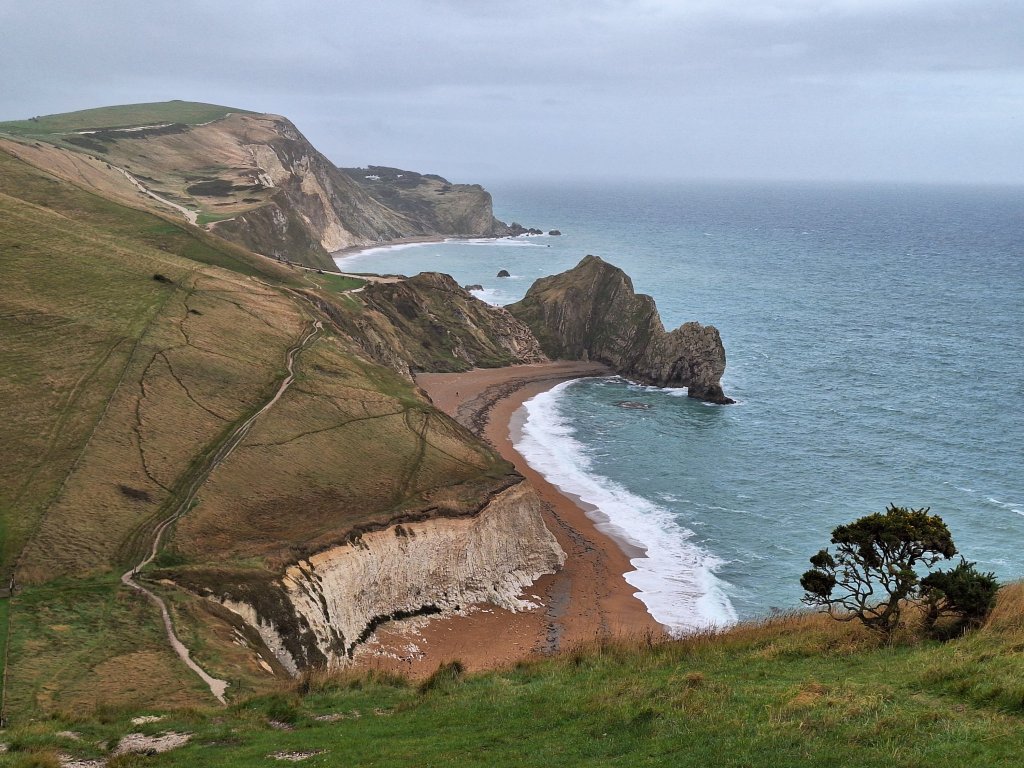
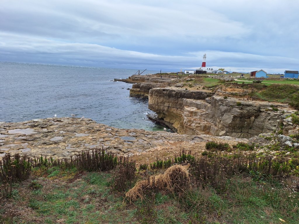
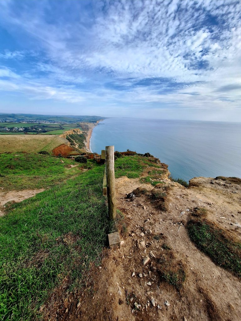
Standing up after lunch I considered stopping for the day, knowing that I had already walked the onward route to Swanage last year, but ultimately decided to carry on. The coastline here of low chalk cliffs is gentler to walk than the previous few miles although the path turned rugged before Durlston. After his mainly inland walk from Lulworth to Worth Matravers (which lies inland from St Aldhelm’s Head), Dad really enjoyed this stretch. I ticked off the landmarks of Winspit, Seacombe and Dancing Ledge but most of the afternoon passed in a blur, with the legs feeling the work of recent days; perhaps my limit of consecutive hard days walking is 10, make that 9. I can only admire Dad who did 16 straight, often longer, days carrying his kit at age 77.
WinspitSeacombe Dancing Ledge
I’d decided that at Durlston I would phone Rob to pick me up and could continue from there for the final day. No signal! When I did manage to get through, it was to discover he was in Swanage centre without the car, so we met up and walked to the B&B a mile on the far side of Swanage. 14.5 miles all told leaving a shorter walk for tomorrow.
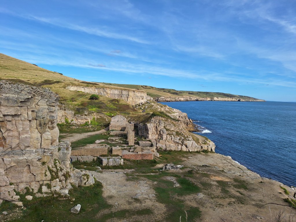
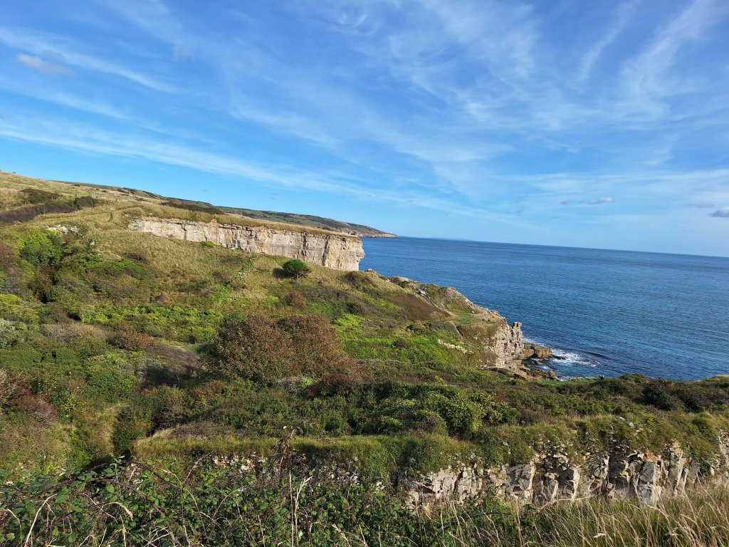
Tilly Whim Caves – part of Durlston Country ParkView north from Durlston Country Park towards Harry’s Rocks
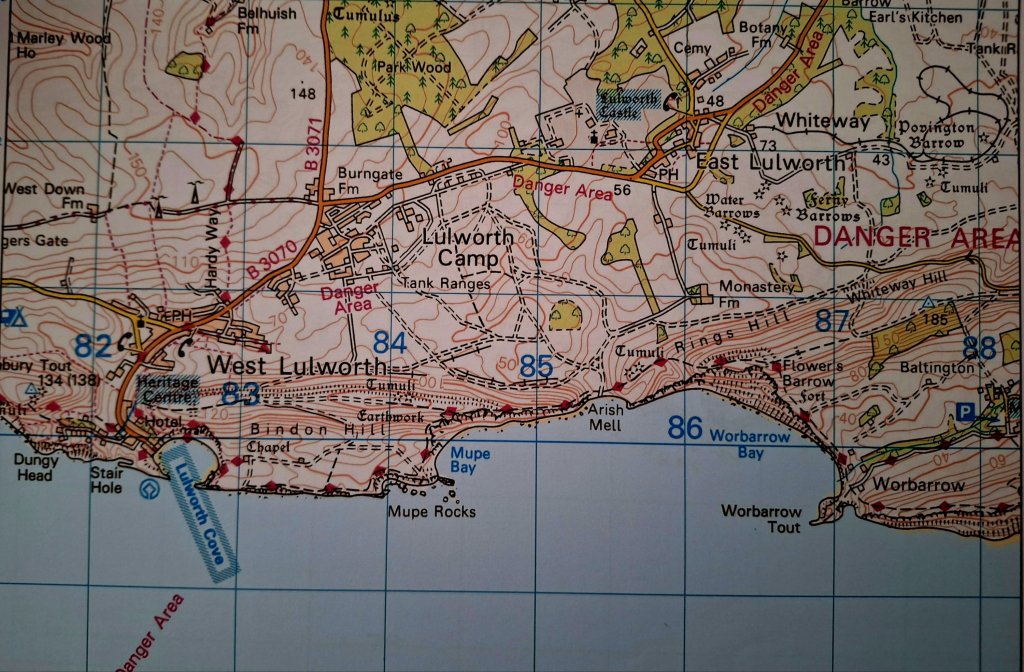
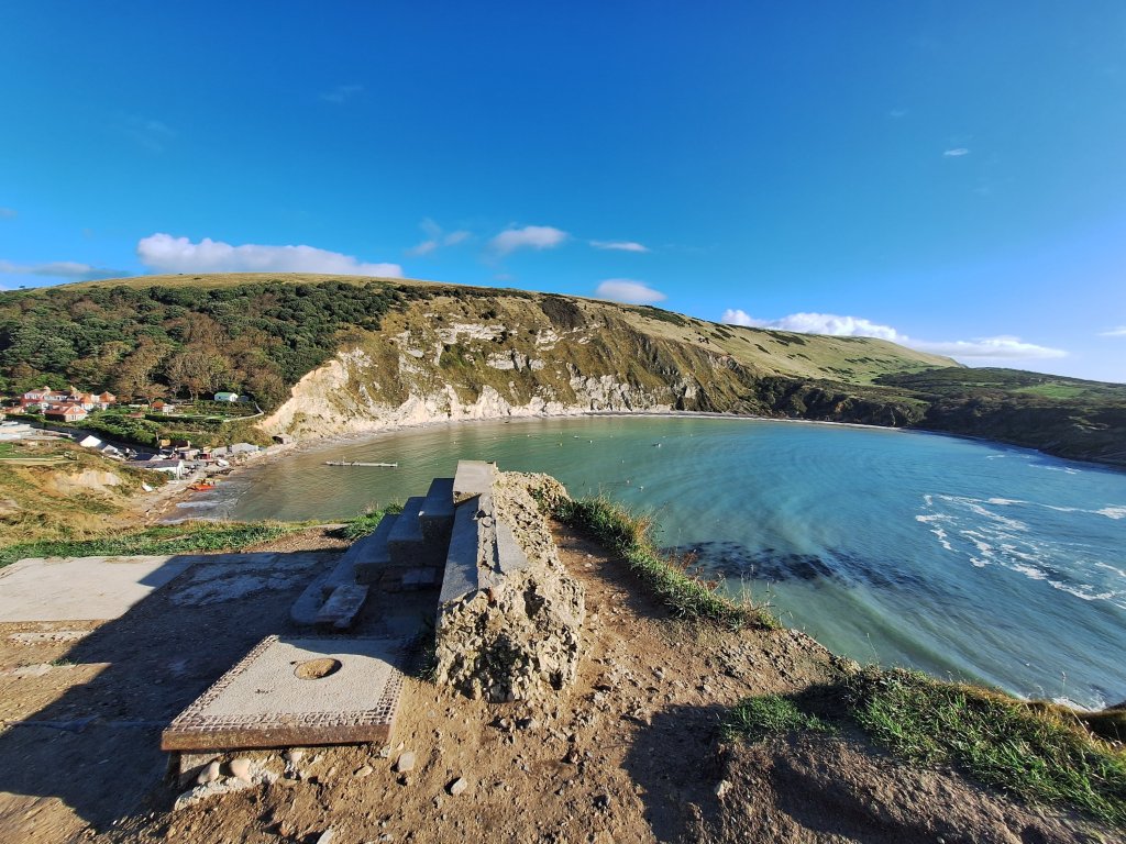
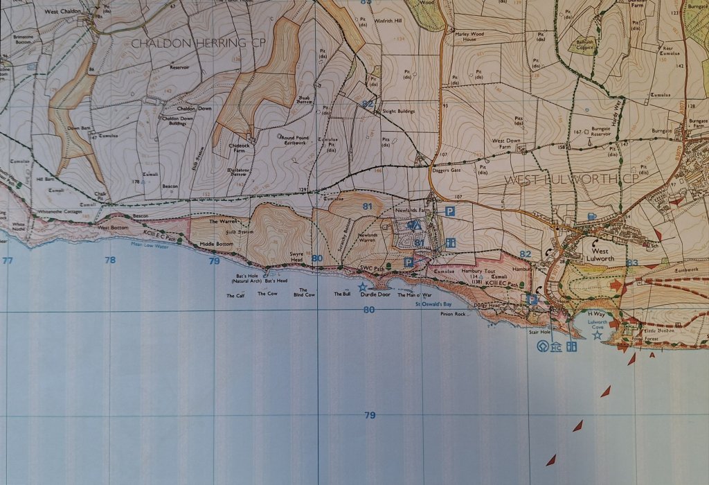
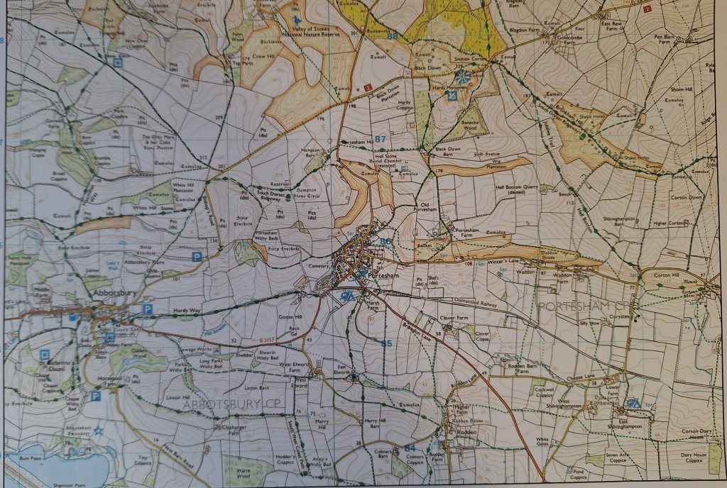
Just 28 miles over 3 days to go. As there is a lack of accommodation on this remote coastline, Paddy Dillon’s guidebook describes a 20-mile day from Lulworth to Swanage. Even Dad didn’t plan to go that far, booking to stay at Worth Matravers, although as he had to make a significant detour around the Lulworth military firing ranges, he probably did walk a good 20 miles. The complication being that the SWCP goes through the Lulworth ranges and these are generally only open to the public most weekends. Dad arrived on a Tuesday seemingly expecting to walk the coastal route and I can only conclude he didn’t have the guidebook (I bought my copy of the 1998 guide on eBay) as it clearly states the opening times. Having read this is a section not to miss, I planned accordingly and also drafted Rob in to help divide the 20 miles into two uneven stages, Lulworth to Gaulter Gap / Kimmeridge today, Gaulter Gap / Kimmeridge to Swanage tomorrow.
Two alternative routes to Gaulter Gap for when the ranges are closed were described in the 1998 guide book but Dad didn’t follow either. He took the B road to East Lulworth then West Holme, before heading east on narrow lanes and then finally on a path to a ridge above Church Knowle and from there covered another 3 miles at least before arriving back on the coastal path probably near Gaulter Gap. Even then, his difficult day wasn’t over, but that’s a story for tomorrow.
The overnight rain had cleared, the wind had dropped from yesterday and it was a beautiful, though chilly, autumnal morning. After showing Rob the highlights of Lulworth, we started along the beach, supposedly walkable at most stages of the tide, although even 2 hours after high tide today care was required to avoid getting wet feet.
Lulworth cove from the Stair Hole viewpoint Lulworth beachLulworth Cove taken from the far side of the beach
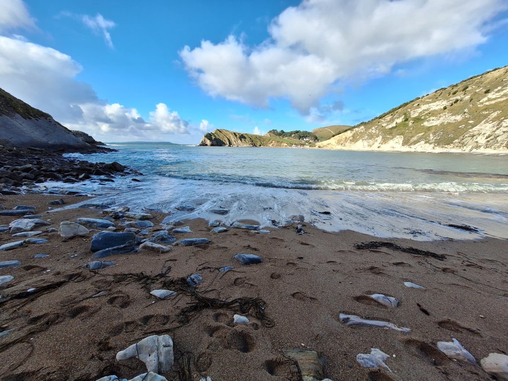
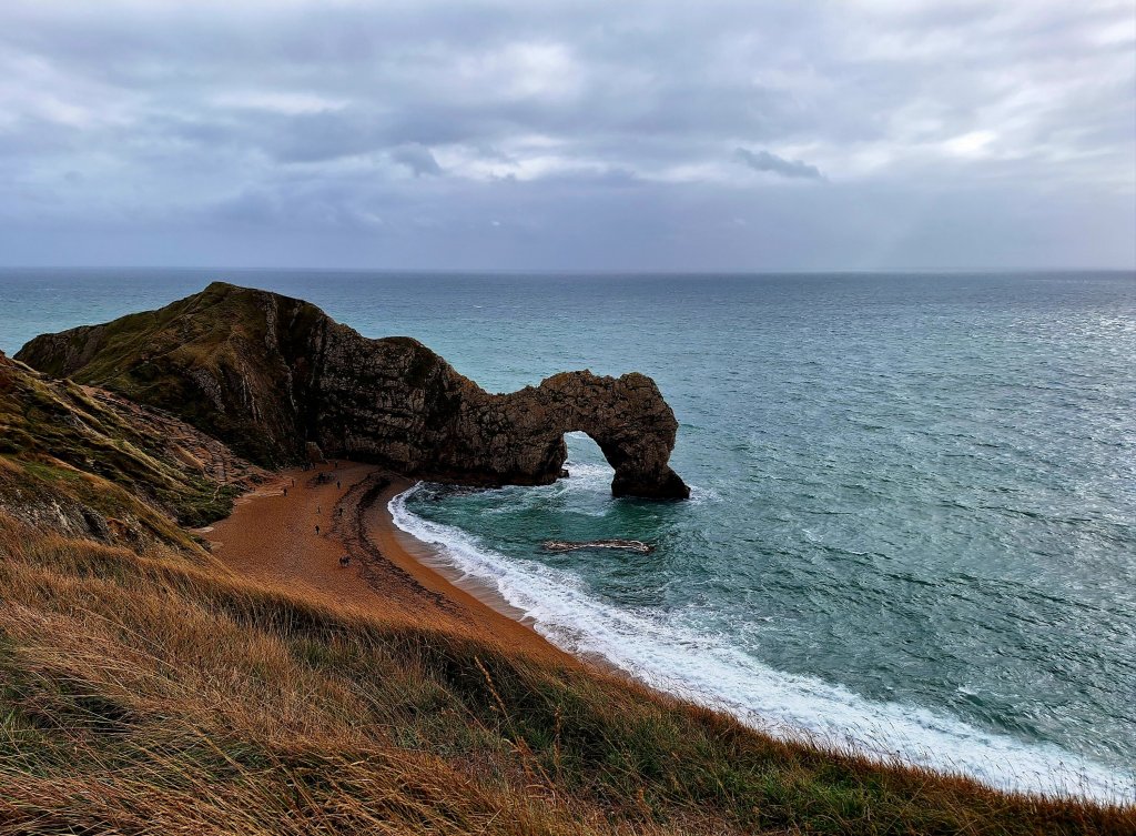
Rob left me to finish the beach walk shortly before the flight of steps up the cliff and I soon arrived at the Lulworth ranges entrance, where a sign exhorted walkers to keep between the yellow markers and avoid touching anything metal. There followed a flattish mile or so, with the sea sparkling and Portland in the distance across the bay, until a headland of striated rock revealed the reason this stretch of the coast is a must-do part of the SWCP. The chalk cliffs dropping precipitously into the grey-blue waters of Mupe Bay, the waves crashing onto the rocks that have fallen from those cliffs and the view that continued to Worbarrow beach and Audlem Head beyond was simply breathtaking.
The chalk cliffs of the Lulworth ranges come into viewMupe Bay
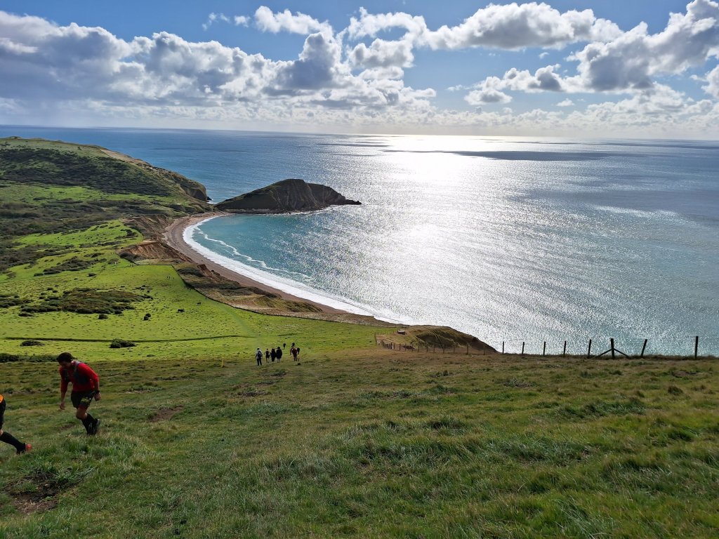
A convenient picnic bench above Mupe Bay allowed for a rest before tackling the almost vertical climb ahead, one of the reasons this section is rated as severe by the SWCP Association. There was a short respite along the gorse-covered cliff top with views across the scrub-land of the ranges before a steep descent and another climb (not quite as bad). At the top, I phoned Rob to give a progress report and, distracted, mistakenly pressed straight on following some runners, rather than turning right downhill. I had walked nearly a kilometre before realising my mistake. Back on the correct path, groups of ‘runners’ were walking up the steep slope, apparently participating in a 56-km ultra race; the person having the best time was probably the marshal at the top ringing a bell in encouragement as they passed.
The descent towards Arish Mell with Flowers Barrow and Worbarrow Bay aheadDescending to Worbarrow
Worbarrow, where Rob and I had planned to meet for lunch, was swarming with people. There were runners, their supporters, a large group of wild swimmers, people and their dogs visiting the beach as well as walkers taking the opportunity to walk on the ranges. Rob arrived shortly after me and fortunately, despite the number of people around, we found a bench on which to enjoy lunch.
Worbarrow beach
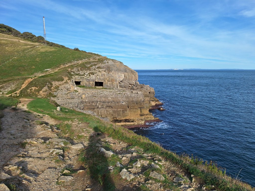
The onward route, steep at first, with runners still on the path, ran above the attractive valley in which the abandoned village of Tyneham nestles and safely below the crumbling edge of Gad Cliff. At the end of these cliffs, the path turned right to drop down gradually towards Gaulter Gap, with tidal ledges exposed along the shoreline. Looking back, Gad Cliff was seen to resemble a jagged flight of stairs. Passing out of the Lulworth Ranges, I met Rob and we headed up to Kimmeridge and the car, stopping en-route for an ice cream. I had walked just under 10 miles including the detour, glad not to be continuing all the way to Swanage today.
Day 8 and so far the weather has been kind. However, an amber weather warning for heavy rain across the southern part of England today has been in place since Wednesday, with the forecast suggesting this would be accompanied by strong winds, down here at least. Not the best forecast when planning to tackle this, in part, high-level, roller-coaster and remote route. A back-up plan was certainly needed. When the day dawned, the local forecast was better than expected although the weather warning remained in place. So it was a matter of going with the flow and being flexible, mindful of escape routes, of which there were several.
At 9am, it was dry and breezy, a green-grey sea rolling on to Weymouth beach, but murky across the sea, the chalk cliffs that surround Lulworth invisible. A brisk 2-mile walk along Weymouth Esplanade was a good warm-up for what was to come. The waves became larger as I moved from the shelter of the bay before reaching Overcombe and a low cliff. A cafe on the hill kindly provided some takeaway sandwiches for my lunch later. From here, Portland reared out of murk, with the lighthouse at Portland Bill just visible.
Weymouth beach at 9.15 in the morning View back from Fuzzy Cliff above Overcombe
The path descended to a gaudy amusement park at Bowleaze Cove and skirted a large former hotel. The low cliff that followed, above a rocky shoreline, was more exposed to the wind now and Portland had virtually disappeared. Clouds scurried past carrying the rain elsewhere.
It was an undemanding walk to Osmington Mills with the sea below me. Here, the pub looked inviting but as I didn’t need lunch and it was only 11am, it was onwards to Ringstead, with the steep cliff of White Nothe ahead. Ringstead was the first place I needed to consider my route options. Having no reason at this stage to deviate from the original plan, I carried on, hoping to be able to complete this section, which Dad had very much enjoyed, all the way to Lulworth.
Above Osmington Mills Approaching Ringstead with White Norte ahead
It was occasionally quite gusty during the gradual climb up White Nothe but as the wind was blowing in from the sea, it wasn’t really a concern and sometimes assisted me up the slope. I did however opt out of walking to the exposed summit, taking lunch in a field just beyond it. My next decision point came after another kilometre, where I had thought the descending path might be tricky in the wind and escape inland was possible. In the end, the descent was trouble-free, sheltered and well away from the edge, the view ahead stunning. The roller-coaster continued with two more steep slopes to descend and ascend, but as a reward I had the white cliffs, the beaches beneath them and the mesmerising sea all to myself. At one point, the dark clouds out to sea moved in and there was a brief shower but the forecast heavy rain never materalised.
The descent towards Durdle Door was probably the steepest of the day but the scene ahead was spectacular. Here, of course, I encountered tourists but not too many. It was a good path up and over to Lulworth where I turned off my watch and became a tourist myself, visiting the Stair Hole, where the effects of erosion shaping the coastline and the extraordinary folds of rock known as the Lulworth Crumple.can be seen, and also a viewpoint over the horseshoe bay of Lulworth Cove. Then, I had time to relax in a cafe before catching a bus that passed very close to the B&B in Winfrith Newburgh, booked for the next 2 nights, to await Rob’s arrival.
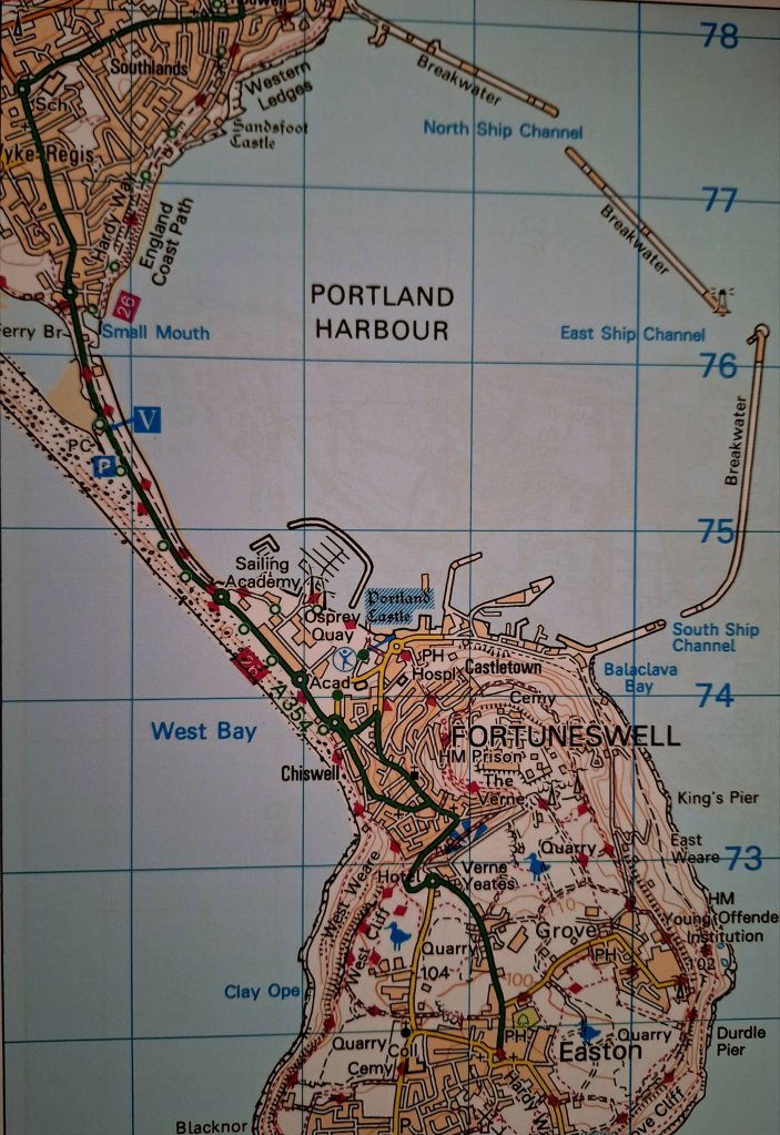
Just four miles long by a mile-and-a-half wide at its widest point, Portland marks the southernmost point of the Jurassic coast and is joined to the mainland by a narrow spit of Chesil beach. Portland officially became part of the SWCP in 2003 and was only an optional extra in 1998; Dad didn’t do it, heading off from Weymouth straight to Lulworth. He missed out on a unique experience.
Rob and I visited Portland last year, parking at the high viewpoint in Fortuneswell overlooking Chesil beach and took a short circular walk to both sides of the north part of the island linked by residential roads. It was nothing special and I wasn’t sure therefore what to expect from today. Now I know that we didn’t experience the best part of Portland; the rocky scenery and coastal wildness beyond Fortuneswell, the far end of the island and the east side (except the blight that is the perimeter fence of HM Young Offenders Institution) and the final descent to Castletown were all thoroughly enjoyable. These areas are probably fabulous at anytime but today were accentuated by wonderful autumn skies, both light and dark, vivid and moody.
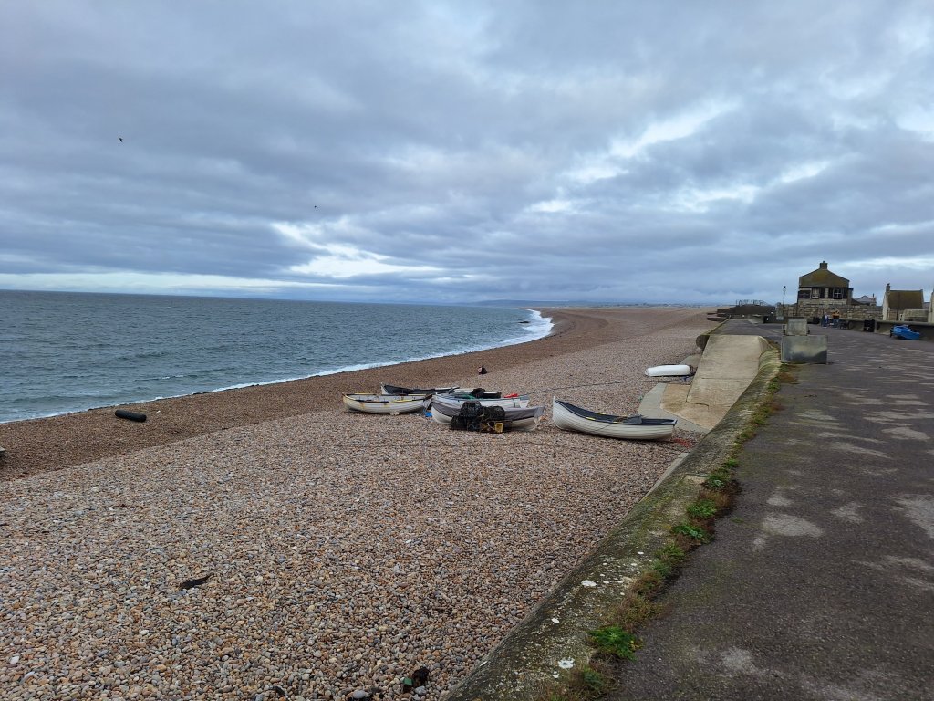
A brighter day than yesterday awaited as I headed to the Portland bus, with the sea in Weymouth Bay beautifully calm, although the tops of some of the cliffs around Lulworth were shrouded in cloud. As I gained the cliffline in Portland, the ridgeway walked yesterday could be seen all the way to Osmington Mills although the highest parts were obscured by mist. Below, in contrast to Weymouth Bay, waves noisily pounded Chesil beach.
Chesil beach from the short promenade at the start of my walkChesil beach as seen on the climb up the cliffs from Chiswell
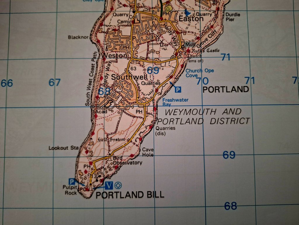
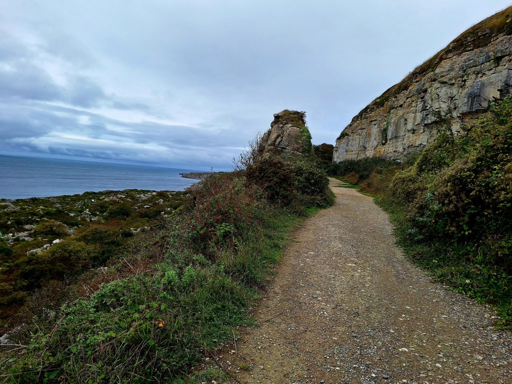
The continuing path along the cliffs was easy and level, with a couple of short diversions inland where the cliffs are unstable, with a wild feel away from human habitation for a couple of kilometres, then with some unattractive housing estates and a business park on the inland side for a while. Another mile of open clifftop followed before the distinctive red and white striped lighthouse of Portland Bill appeared ahead at the southern tip of the island, with a tide race and moody skies behind. Here, there is a cluster of buildings of the MoD, the coastguard and a popular takeaway. Lunchtime beckoned.
The stone sculpture park in the former Tout Quarry through which the SWCP had been divertedThe crumbly cliffline leading towards Portland Bill
On a clear day Portland Bill affords extensive views along the coastline in both directions. Today, Durlston Head near Swanage was visible but in the other direction the end of Chesil beach was not. Turning north along the east coast, I headed through a collection of little huts, both brightly-coloured and pastel shades, with two tide races seen a few hundred metres off the shore but the sea reasonably calm close to the cliffs. It was a totally different coastline on this side of the island, fine lower cliffs (at least for a while), piles of limestone everywhere set against the dark sea and sky, the path lined with an abundance of withering wild flowers, the chalk cliffs of the Lulworth area getting nearer and clearer, although still with some lingering mist, peaceful yet exhilarating.
Portland Bill appearsLooking back to Portland Bill
After a 2-kilometre stretch of path, the route follows the road for 600 yards before descending into an unexpectedly beautiful undercliff area (the Southwell landslip) that tortuously delivered me to one of the most stunning beaches, Church Ope Cove, I’ve been on anywhere in the world. Smooth limestone pebbles of varying sizes set against the bluey-green sea rolling on to the shore and varied coloured beach huts backing onto it. I sat for a while just absorbing it and found it hard to tear myself away.
The undercliff area heading towards Church Ope Cove Descenting to Church Ope Cove The beach at Church Ope Cove
A climb up a long flight of concrete steps followed, reaching a view point, continuing above another huge undercliff area and below some increasingly high cliffs (Grove Cliff). The chalk cliffs of Lulworth and beyond were now clear.
Grove cliff area
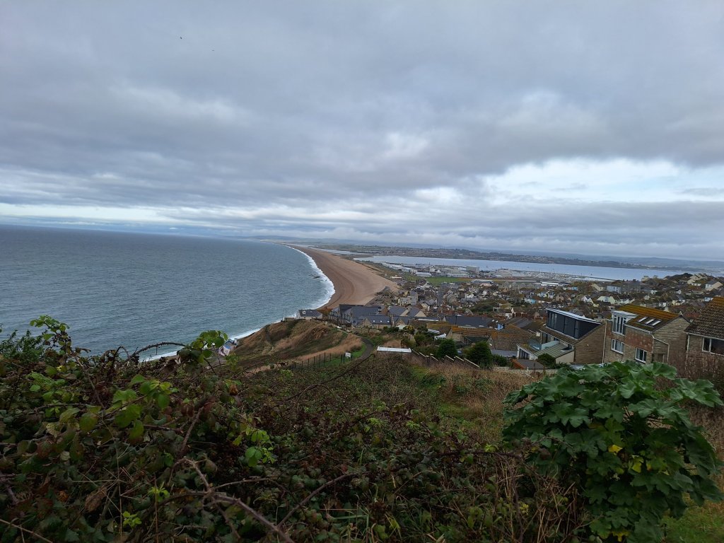
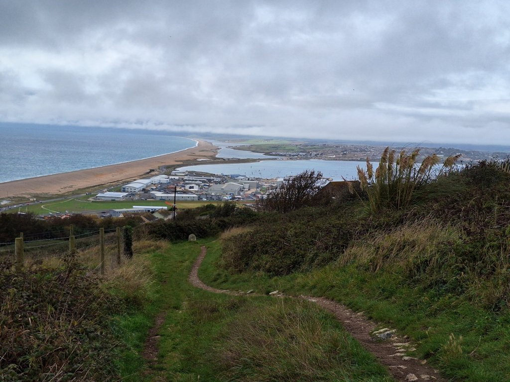
Eventually the high cliffs had to be climbed, with the path zig zagging upwards and at the top I found myself walking alongside the aforementioned perimeter fence of the young offenders institution. Continuing, I passed a motorhome and caravan site with high wired fencing topped with barbed wire and a view straight towards it. Not an attractively-situated campsite but seemingly the only one on the island. A steep descending flight of stone steps then picked up an old railway track path with views of the Fleet lagoon, Chesil beach and later, as it dropped down, the marina area. I was soon back at the bus stop with 11 miles (nearly all of them fabulous) walked, a day that ranks as one of my favourites on the SWCP.
Dad wasn’t particularly enthusiastic about his day walking from Abbotsbury to Weymouth, describing it as away from the sea, across fields and near military areas followed by a plod through urban Weymouth. Having done one of the better parts of the route (from near Langton Herring to East Fleet farm) when Rob and I visited Weymouth last year, I decided to continue with the inland ridgeway route started yesterday, a mini-adventure within the main one to see how far I could get and with an open mind about whether to continue into Weymouth on foot or by bus.
Photo taken on my walk in April 2022, path down to the Fleet Lagoon from Langton Herring Another photo from April 2022 looking back as I crossed Herbury towards Gore Cove (where Dad ate his lunch during his walk)
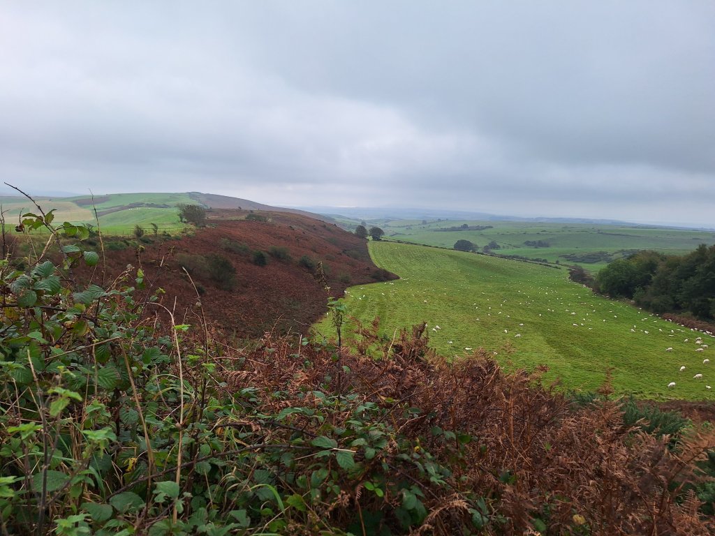
It was another grey morning but the ridge was clear although having reached it, the view seaward was murky with the Fleet Lagoon visible but Portland blended into the cloud. A few pools of sunlight danced on the sea east of Weymouth but the sun failed to break through where I was throughout the day. The route was initially straightforward becoming less so approaching Hardy’s Monument just over 3 miles from Abbotsbury. At a height of 239 metres, conditions up there were breezy and it seemed best to carry on without stopping for a rest. There followed some easy ridge walking for the next 4 miles or so until lunchtime, with gloomy conditions continuing both seaward and inland, although Portland was gradually becoming more discernible.
Hardy’s Monument as seen on my way to Blonkham HillLooking towards Blonkham Hill
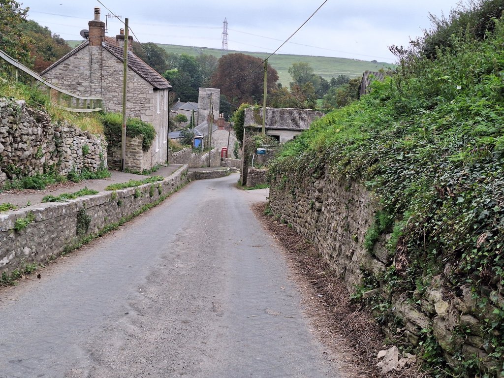
Pressing on after lunch my aim was to reach the hamlet of Bincombe before planning how to get to Weymouth. My decision to continue to the village of Osmington, just a mile or so from Osmington Mills, where the South Dorset Ridgeway meets the main SWCP, was a good one as those last 3 miles were the most enjoyable of the day. With a bus to Weymouth scheduled half an hour after I reached the village it was pleasing to find a bench, the first encountered since Hardy’s Monument, to rest and refuel after my 13-mile hike.
An unexpected delight encountered on my way to BincombeThe hamlet of BincombeThe village of Sutton Poyntz with the sea behindWeymouth and Portland taken from West Hill
Day 6 ended at a B&B tucked away down a quiet street a stone’s throw from the Weymouth seafront and where I will be based for 2 nights. Soaking in a welcome bath, it was pleasing to reflect that I didn’t feel as tired as on arrival in Plymouth last year after 6 days on the path. Good thing as there are still 5 days to go to South Haven Point.
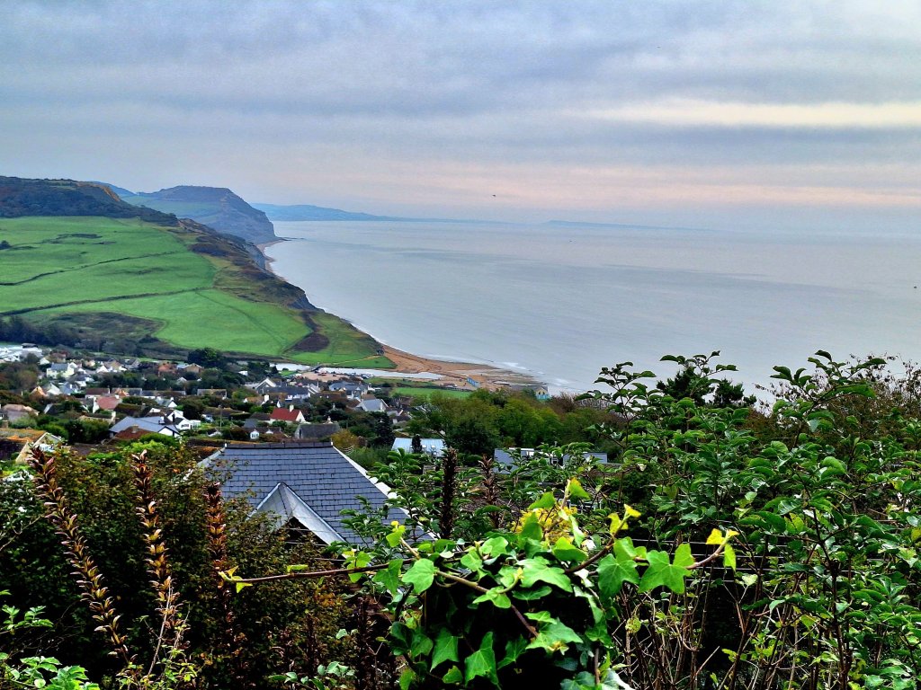
A change in the weather today with the temperature back to the seasonal average but with low cloud shrouding Thorncombe Beacon and inland so I was pleased to have completed the high section yesterday.
Golden Cap and Thorncombe Beacon this morning from Eype’s Mouth
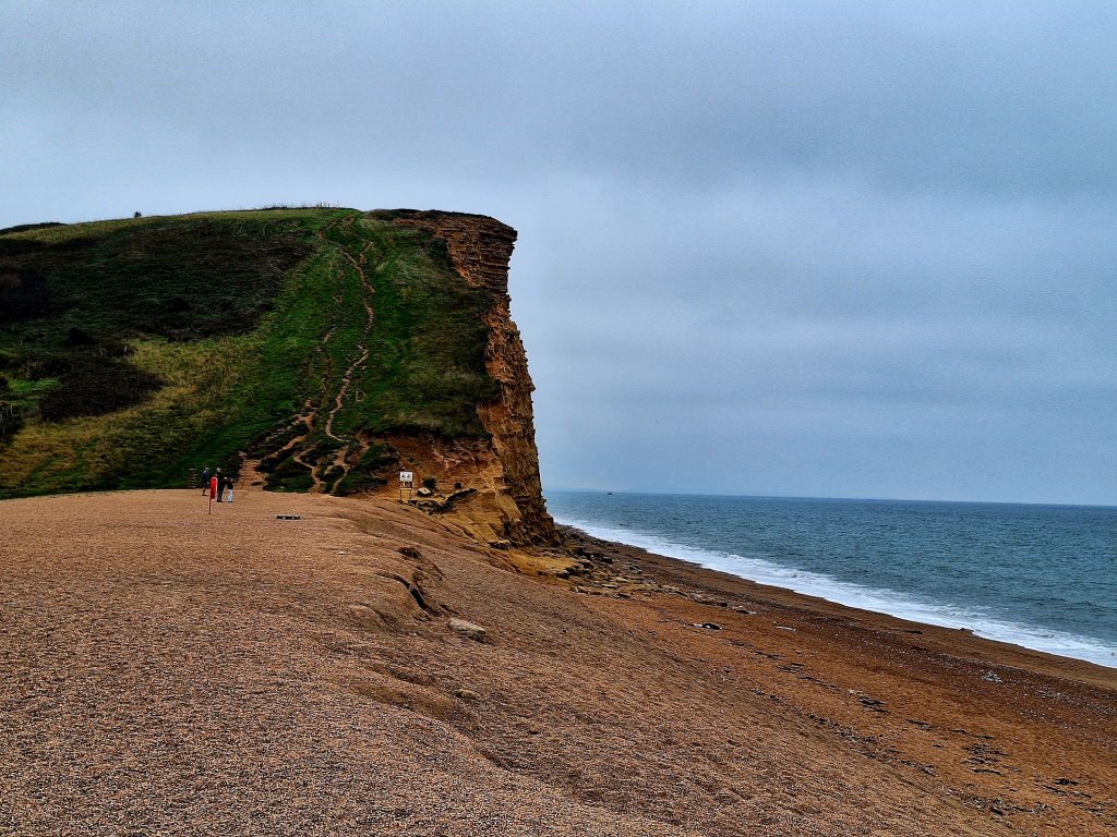
The sea was grey at Eype’s Mouth, although the waves bigger than on previous days. From there, it was an easy climb over to West Bay. Here, the cliff rises extremely sharply from the beach but due to a recent landslip the SWCP Association website states a temporary diversion has been set up, with the path diverted over the golf course behind. On the ground, there didn’t seem to be a diversion sign but no-one was climbing the cliff either so I hedged my bets and took the diversion. Avoiding the golf balls, I arrived at a large caravan park, a labyrinth in which I mislaid the path, but eventually I was back on track up the next cliff with the sea below audible; behind me the gloom had intensified but there were pools of light out to sea.
The path up East Cliff rising almost vertically from West Bay beachLooking back from Burton cliff having escaped from the caravan park
Arriving at Hive beach at 11.05, it was too early for lunch and I thought the 3 miles to West Bexington and its pub could be achieved in time for lunch. It was, but it was a hard 3 miles, with almost half on Cogden beach, where stones the size of pea gravel made for slow progress.
Approaching Cogden beach
The pub was 500 metres up the hill from the beach. Sat outside were five walkers from a walking group through which Dad and Mum met nearly 70 years ago, small world and amazing it is still going. Lunch of soup and a salad, eaten outside, was delicious.
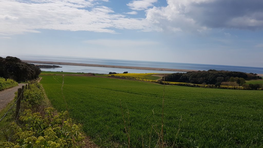
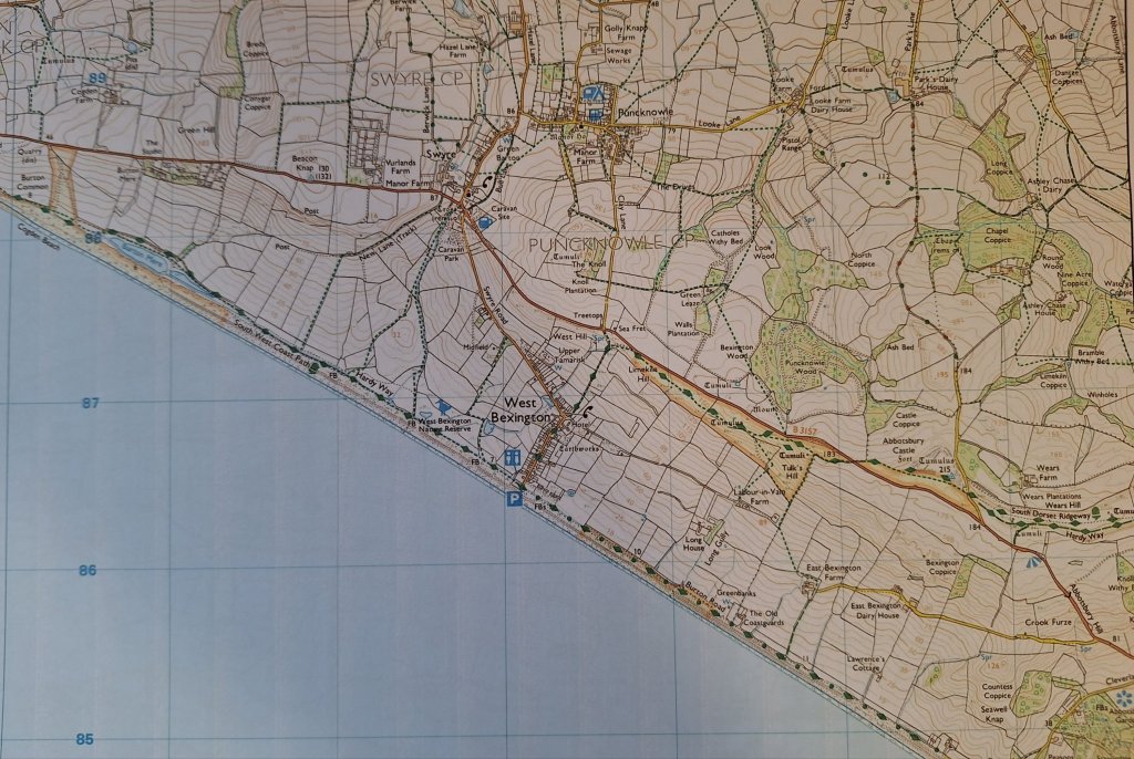
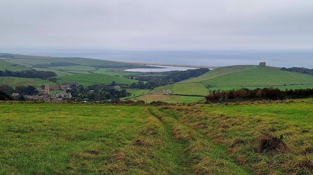
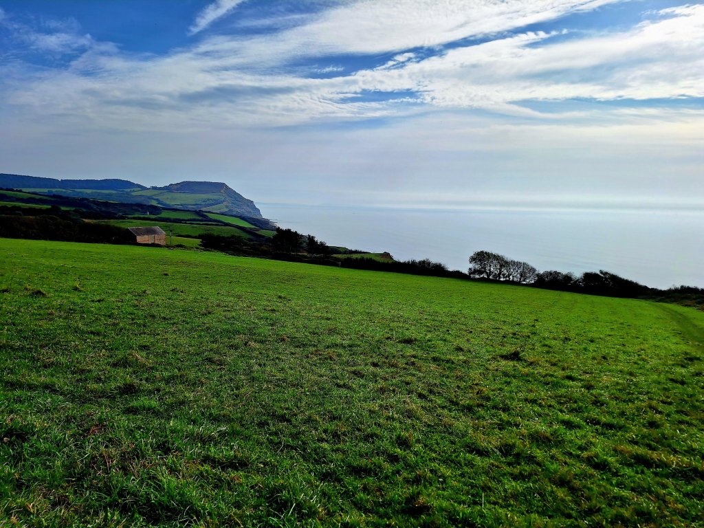
When I had arrived in West Bexington the SWCP seemed to continue along more shingle, at least initially, and already part the way up the hill I decided to pick up the alternative inland coastal path to get to Abbotsbury. This officially recognised route, now known as the South Dorset Ridgeway, runs from West Bexington to Osmington Mills and provides (on a clear day) expansive views of the unusual coastline, including the 17-mile-long Chesil beach and the 8-mile-long tidal Fleet lagoon, and the island of Portland, with tantilising glimpses of the tops of the Jurassic cliffs eastwards. Today, I walked the first 3 miles, which once the initial height had been gained, was reasonably level and I found myself descending to Abbotsbury before 3pm, having walked more than 12 miles, a couple of miles further than the official distance, despite taking that inland, and probably, slightly shorter route. Maintenance works were being undertaken at Abbey House B&B and as a consequence my room was upgraded to one with a huge bathroom as well as a choice of two large beds. Having sorted myself out I had time to enjoy a cream tea at a friendly nearby cafe. Sadly, service at the only pub open for dinner was very different, totally lacking warmth, while the food was barely passable.
Seaviews accompanied me as I walked across Limekiln Hill Chesil Beach and the Fleet Lagoon come into sightDescending to Abbotsbury
Other than the pub lunch, which was excellent, I didn’t particularly enjoy this section. Dad didn’t either, seeming to have walked for longer on the beach than I did, and then after West Bexington, although the shoreline path seems clear on his map, he somehow found himself up the hill near the Labour in Vain farm arriving in Abbotsbury via a back lane.
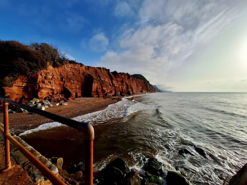
My first full day in Dorset. Dad commented that he found much of the Dorset path to be inland rather than true coastal, a statement I found surprising when looking at his maps, although reading his diary entries reveals he mislaid the coastal path and/or encountered an inland diversion on several occasions, so perhaps he wasn’t exaggerating after all. However, this morning’s walk to Charmouth is indeed some considerable distance from the coast, much further than in 1998. Multiple landslips of the cliffs of Timber Hill since 2001 have necessitated a permanent rerouting of the path above Lyme, completed in 2022, and not reflected on the OS map. On the plus side, a path has been developed for the climb out of Lyme, whereas Dad had to initially follow the main road.
The unstable cliffs of Timber Hill as seen on the climb from the far end of Lyme beachDad turned right here to walk along the cliff top, whereas I had to go much further inlandCharmouth, Golden Cap and the coastline continuing all the way to Portland as seen on the descent of Timber HillCharmouth beach where I enjoyed a short break, with Lyme Regis in the distance
In Charmouth, the path headed towards the beach, apparently popular with fossil hunters, but also a nice place to relax in the sun and enjoy the sound of the waves. The SWCP out of Charmouth climbed directly up Stonebarrow Hill now following the Monarch’s Way (which continues along the coast as far as West Bay). With the sea on my right and rural Dorset to my left, the descent that followed was very pleasant in the increasingly warm sunshine. Dad bought his lunch in Charmouth and states that he ate it up a hill that resembled the side of a house; no hill in the vicinity of Charmouth matches that description, although 3-4 contours on the map are close together, maybe as he lunched really late he was tired and hungry and it just felt vertical.
Then came the ascent to Golden Cap. Gradual at first, this steepens to reach a fence line with two benches, one of which I was offered by a couple heading upwards. Although the plan had been to eat lunch at the top, it seemed churlish to turn the offer down and with Lyme Bay in front of me it was a great spot and more exclusive than at the top.
Approaching Golden Cap Lovely autumn foliage on the early part of the ascent of Golden CapLunchtime view
When it came, the view east from the summit of Golden Cap was stunning, calling for another stop. It was a bit hazy but Portland could be seen in distance and the red/orange cliffs east of Seatown and the red beach dominated the foreground. Crossing over the top of this hill, the highest point on the south coast at 191m, also revealed a panorama of undulating countryside. The day Dad was here was perhaps hazier than today as he seemed disappointed. I was amused by his other comment that he ‘had to quell feelings of his superiority for being a long-distance walker whereas others on the summit were mere daytrippers’! He descended directly to his B&B in Chideock, inland from Seatown, picking up the coastal path again at Seatown the following day.
View east from Golden Cap with Seatown beach in the foreground and Portland in the distance
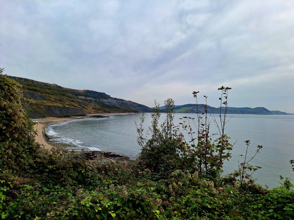
The small village of Seatown, which doesn’t seem to have changed since Dad’s day, was worthy of another break in the sunshine, enjoying a drink in the pub’s cliff garden. There followed the one final ascent for the day, up Ridge Cliff and then over a series of lumps to Thorncombe Beacon, from where Eype, West Bay and the coastline beyond were laid out. The subsequent descent ended just above the beach at Eype’s Mouth, from where a short walk up the road through Eype took me to the hotel, where two complimentary pieces of cake had been left in my room, a benefit perhaps of booking a double room for single use.
Seatown beach and Ridge cliffLooking back to Seatown and Golden CapLooking towards Thorncombe Beacon View from Thorncombe Beacon towards Eype and West Bay. Photo also shows the crumbly nature of the cliff where a previous path has collapsed towards the sea
Dad did this section in a morning and in the afternoon continued to Chideock, inland from Seatown, a long hard day. I’m glad I chose to split it.
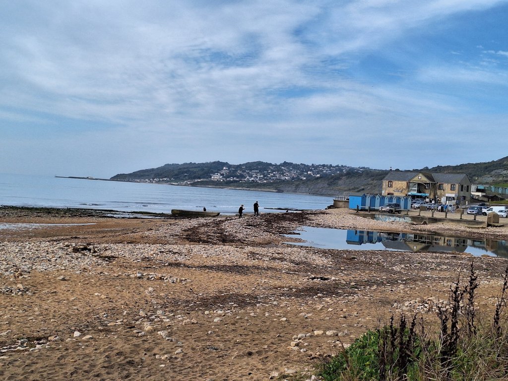
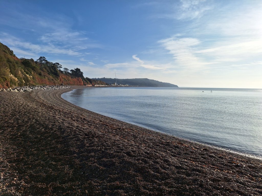
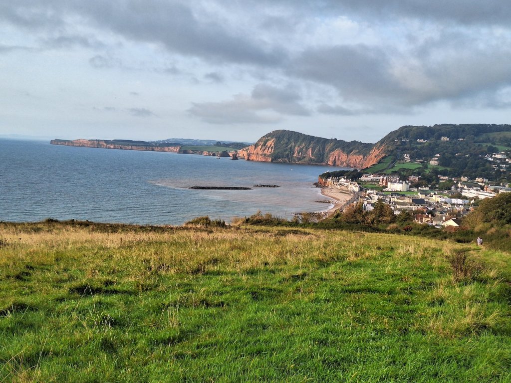
Starting from Beer Youth Hostel, one of the few that remain open along this coastline and which is perched high above the village, Dad took a road directly into Seaton. Having stayed not far from the hostel I could have done the same but preferred to descend from my B&B to the beach, where a glorious, if chilly, autumnal morning greeted me. The calm blue sea sparkled in the sun and a heavy dew glistened on the hedgerows as the path made its way up and over the cliff, although a low bank of cloud hovered over the higher ground inland. After a mile or so, there was a route choice, continue into Seaton on a road or take the pebbly beach, possible today with a receding tide. I opted for the latter route and after half a mile of pebble crunching found myself in Seaton, stopping at a seafront cafe for a second coffee.
Beer beach in the morning sunLooking back at Beer beachBeach walk to Seaton
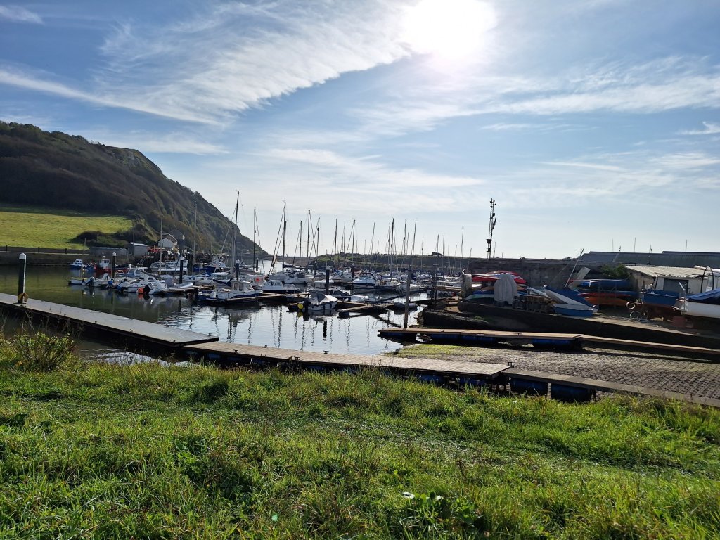
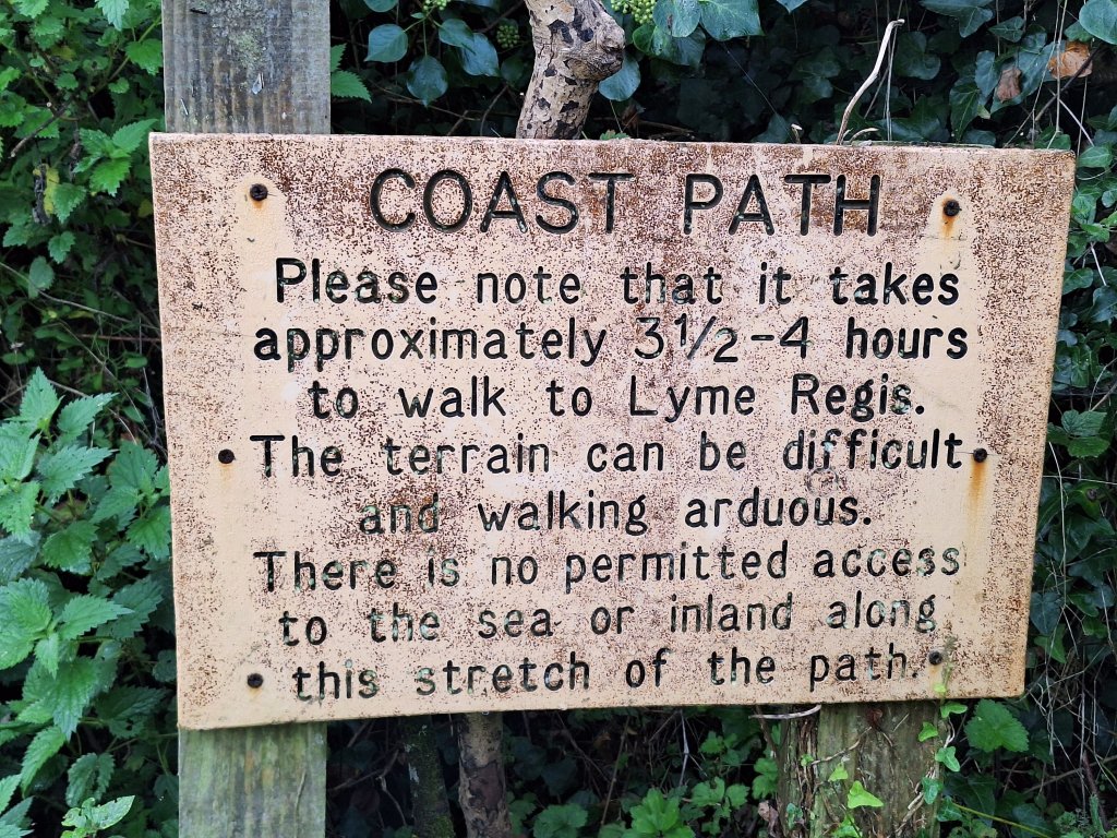
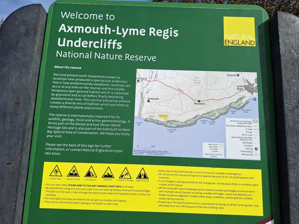
Moving on, I crossed the bridge over the Axe, with the marina to my right and the Seaton marshes to my left. The route then took a steep pull up above Seaton, ran across a golf course and round the edge of and later below agricultural fields, reaching the Axmouth-Lyme Regis Undercliffs – a national nature reserve – after a couple of miles. One last look back to the limestone cliffs of Beer, now reflected in the sea, and I dived into this 5-mile wilderness area of untouched woodland and dense undergrowth, formed by a massive cliff fall nearly 200 years ago.
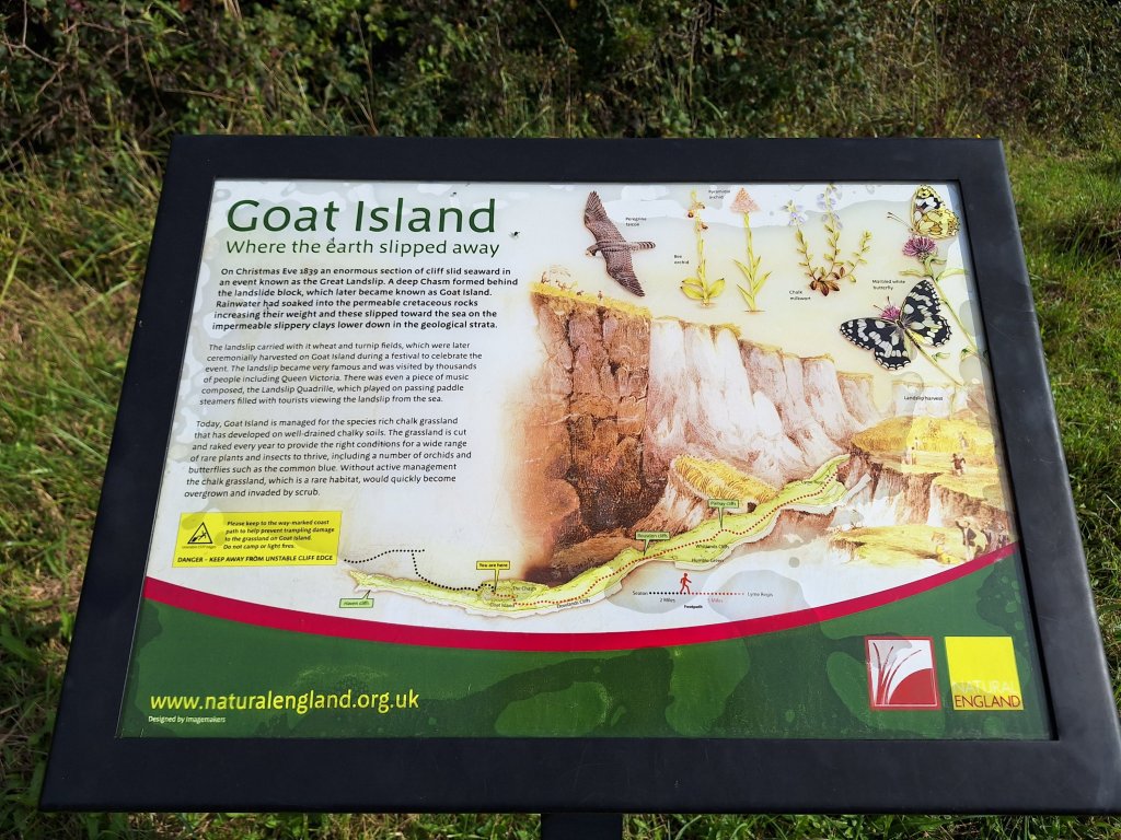
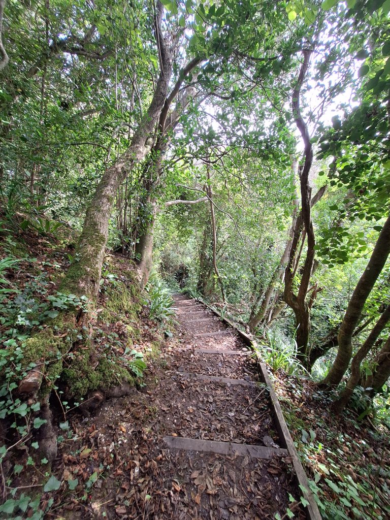
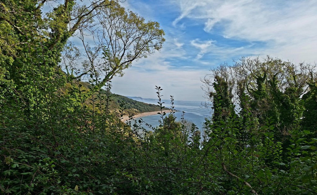
Dad described this section as convoluted and that he sometimes felt he was going west not east and seemed please to exit it. It’s unlikely that the path has been rerouted since 1998 and while some of it was certainly convoluted, I never had the sense of going back west so perhaps the nature of the place just disorientated Dad. After a few hundred yards, the path reached Goat Island, an area that formed behind the landslip block, now a rich chalk grassland maintained as a habitat for rare plants and insects. The narrow path continued up and down through the otherwise impenetrable woodland and undergrowth for a while and I had no awareness of being under cliffs, until suddenly, after a couple of kilometres, a gap in the otherwise dense trees revealed them high above.
Seaton marinaLast glimpse of the Beer cliffsLooking into the Undercliff from by the entranceThe cliffs revealed
I was starting to think about lunch and thought I’d have to sit on a section of felled tree trunk when I came across the most perfectly situated bench looking over to an empty beach washed by gentle waves with the Dorset cliffs behind. Simply gorgeous. And it was unoccupied! As the ‘coastal’ path in the undercliff rarely felt coastal, with only occasional glimpses of the sea, this was a place to linger and enjoy.
The afternoon was more of the same with only one other seaward viewpoint. Later, the path widened and I thought it must be coming to the end, only to be disappointed when it became narrow and rugged again. Eventually, I found myself on a narrow open path with Lyme Regis just a mile away and the Dorset coastline across the bay. After 10 to 15 minutes, the path descended to attractive harbour known as the Cobb before joining the prom to Lyme. On a Sunday in unseasonably warm weather, both prom and beach were heaving and I was glad to escape to the quiet of my B&B some distance up the hill.
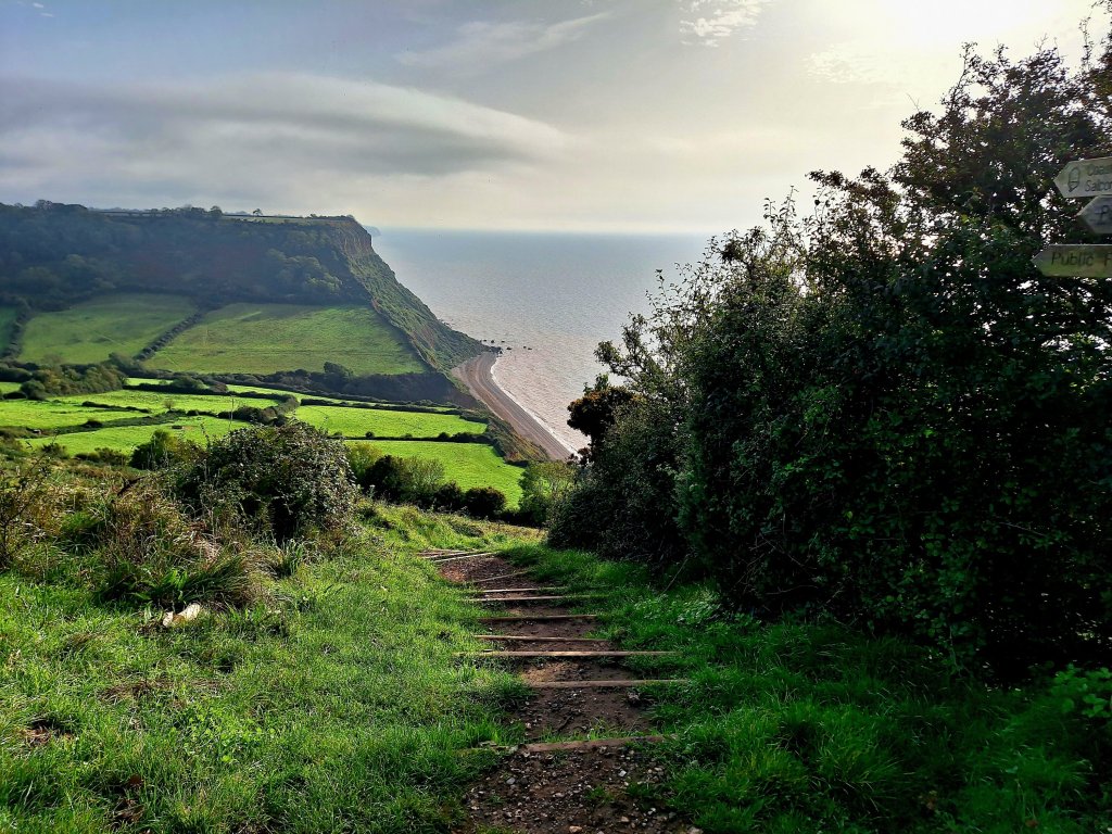
My destination today, the fishing village of Beer, was 9 miles walking but with some steep climbs. There were plenty of people out on this beautiful Saturday morning as I walked along the Sidmouth esplanade. Reaching the end of it, the sheer unstable cliffs necessitated heading inland before the path broke out onto the grassy slope of Salcombe Hill which summits at around 500 ft. Dad, on his way from Budleigh Salterton to Beer, ate lunch here on a bench (still there) with views back to Sidmouth and his morning’s route. He was in for a tough afternoon.
Cliffs at the end of Sidmouth Esplanade The view back to Sidmouth that Dad would have enjoyed at lunch
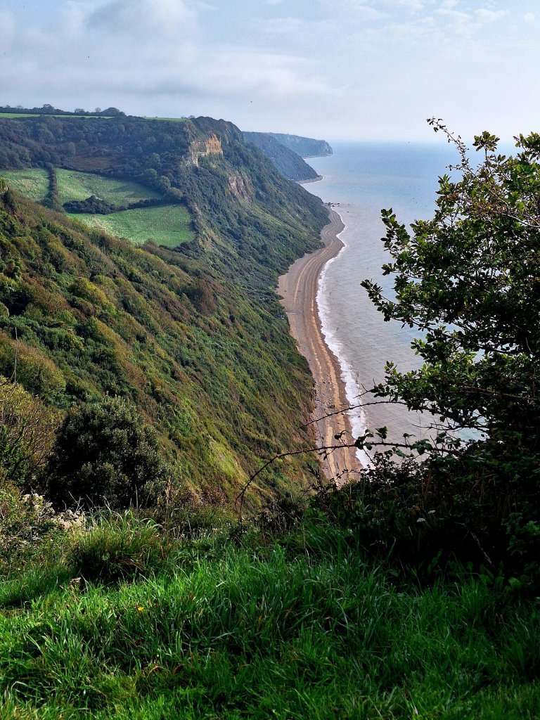
On the summit there is a view marker that includes Guernsey and the Normandy beaches, the latter at least surely cannot ever be visible from this distance. The path levels out for a short distance across fields before plunging down towards Salcombe Mouth, initially by a long flight of steps, but doesn’t reach sea level, crossing a narrow attractive valley before ascending again.
Several well-sited benches along the way offered time to rest and reflect on the stunning surroundings. Arriving at one such bench at the end of Higher Dunscombe Cliff, it looked like the path would again head down a difficult-looking slope but the map reassured that the descent to Weston Mouth was yet some distance and the walking for a while would remain high level if undulating.
The descent when it came was initially through woods and then on steps, the path dipping out right onto the extensive, peaceful, pebbly beach. Three women doing the same walk as me stopped for a dip and momentarily I regretted not having packed a costume. Two kayakers passed as I enjoyed my break (I saw them again at Branscombe Mouth) and I contemplated what it would be like to be kayaking along this spectacular shoreline. I could have lingered longer but having planned to buy lunch at Branscombe Mouth nearly 3 miles distant I had to press on.
Descent to Weston Mouth
The climb back up was steep, mainly via steps and thankfully often pleasantly shaded. Dad described it as gruelling. Having caught my breath, the onward path was reasonably easy; sometimes the sea was obscured by high vegetation, other times a shimmering presence far below and periodically the panorama of the cliffs back to Sidmouth opened up behind me. After about a mile, the path turned away from the sea reaching woodland above the Branscombe valley. Here, Dad’s and my paths deviated. Leaving the official path, he descended to the village hoping for a drink at the pub, only to find it had shut down. His onward route to Beer YHA was via inland lanes and tracks, so not only did he miss out on his drink but also the spectacular scenery beyond Branscombe Mouth.
Looking back during the climb from Weston Mouth. I love the autumn colours in this sceneDescent to Branscombe Mouth with the Hooken undercliff seen ahead
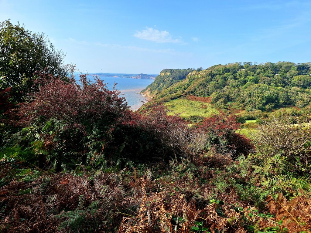
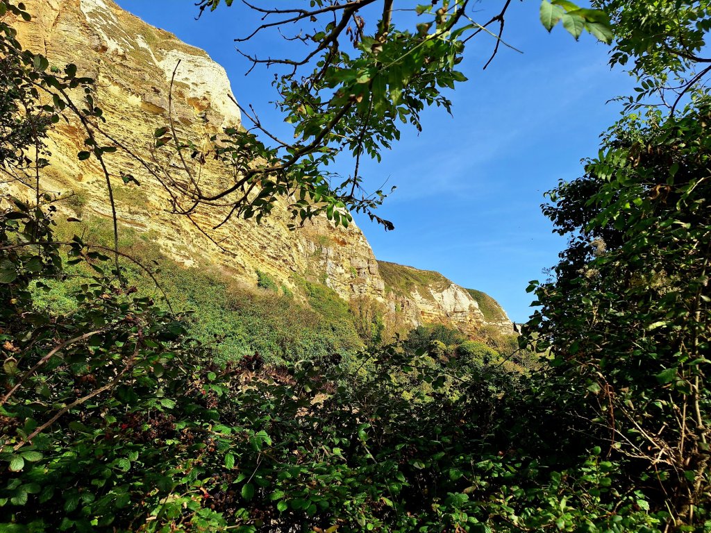
Having enjoyed lunch at the popular cafe at Branscombe Mouth, I headed uphill to the Hooken Undercliff, an extraordinary wooded slope formed by a landslip more than 200 years ago with huge limestone cliffs towering above the path. It was warm and I was grateful for the luxuriant, tangled canopy of vegetation that shades much of the tortuous path before it finally starts to zigzag up the cliff. From Beer Head, with Beer, Seaton and the coastline further east ahead, it was an easy walk into the fishing village of Beer, to end a fabulous day’s walking, and with my B&B on the outskirts of the village having a small garden I could continue to enjoy the sunshine until the sun dipped over the hills behind me.
The limestone cliffs above the Hooken undercliff Looking back from near the top of the climb to Beer HeadView on descent from Beer Head of Beer, Seaton and the Axmouth-Lyme Undercliff (to be walked tomorrow)